
Summer · editorial guide
Crete on foot
By The Tripsenti Team
Crete isn't a hiking destination with a few good trails. It's an island where walking changes the way you perceive the place. In Chania you can start above 1,200 metres and end up in a village accessible only by sea. On Psiloritis you can walk over geological faults and between shepherd huts. In Heraklion, a gorge leads you to one of the island's most important forests. In Sitia, a single trail can, within a few hours, connect Minoan burial sites, an ancient palace, marine terraces, and a beach with no road access.
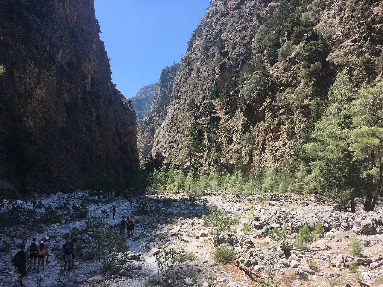
Chania — The White Mountains down to the sea
Western Crete has the island's most dramatic mountain relief. The White Mountains rise sharply above the Libyan Sea, creating a rare network of gorges, mountain passes, and coastal stretches of the E4. What matters isn't just the scale — it's that many routes don't work as closed loops. They bring you out on a different coast, in a different village, or in a place with no road connection at all.
Samaria: the classic crossing starts at Xyloskalo, at 1,227 m, and follows the gorge's downhill flow to Agia Roumeli — 13 km inside the National Park, plus another roughly 3 km to the village, from which the only way out is by boat, since there's no road access.
Sougia–Agia Roumeli: the coastal E4 stretch is about 20 km, very demanding, with a total time that can reach around 11 hours via Tripiti — a route for an experienced hiker, not a stroll by the sea.
Green Routes: the Chania Mountaineering Club has marked ten routes beyond the main E4, including Zourva–Tromarissa, the Sirikari–Polyrrinia gorge, and the ascent Kambi–Volika–Spathi at 2,046 m.
Rethymno — Walking on Psiloritis's geology
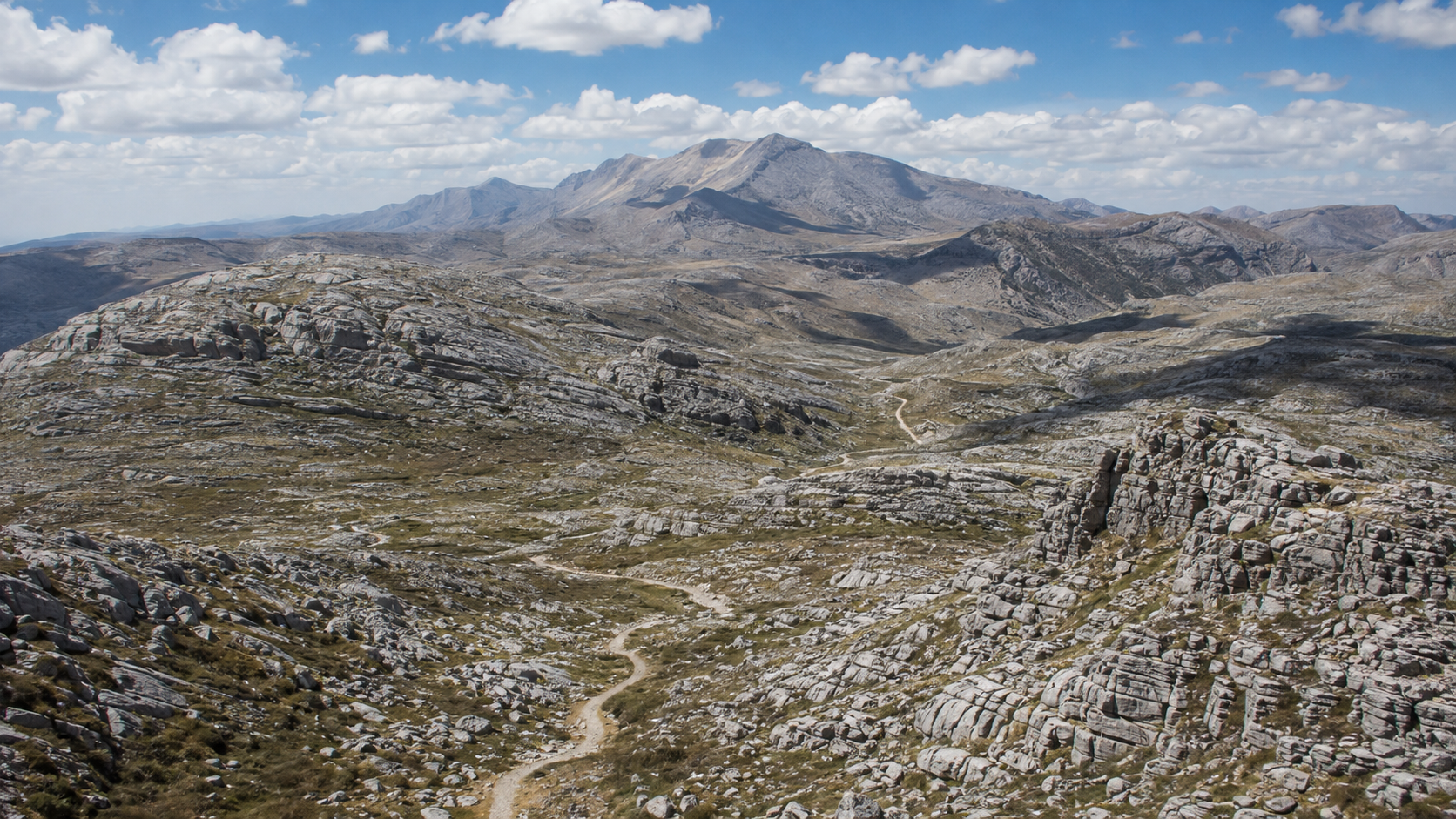
In Rethymno the experience turns more mountainous and interpretive. Psiloritis doesn't just offer summits — it's an entire geological landscape where faults, karst formations, plateaus, and traditional shepherd installations coexist. The Psiloritis UNESCO Global Geopark is one of the best resources for understanding exactly what you're looking at as you walk.
Mygia: a 2.5 km circular trail from the Anogeia–Nida road (roughly 1,050–1,130 m), about 1.5 hours, easy and suitable even for families, with geological interest — folds, karst features, the landscape of the mitata. No water on the route.
Nida and Psiloritis: the Nida plateau is the natural gateway to the high mountain. From here the hiker moves across bare limestone relief toward the higher zones of Psiloritis — sun exposure, wind, lack of shade, and rocky terrain can make a summer ascent far harder than the distance suggests.
Kamares Cave: high on the southern slope of Psiloritis, linked to one of the most recognisable styles of Minoan pottery, Kamares ware — the mountain approach is part of the experience.
Heraklion — From Zaros to the Rouvas forest
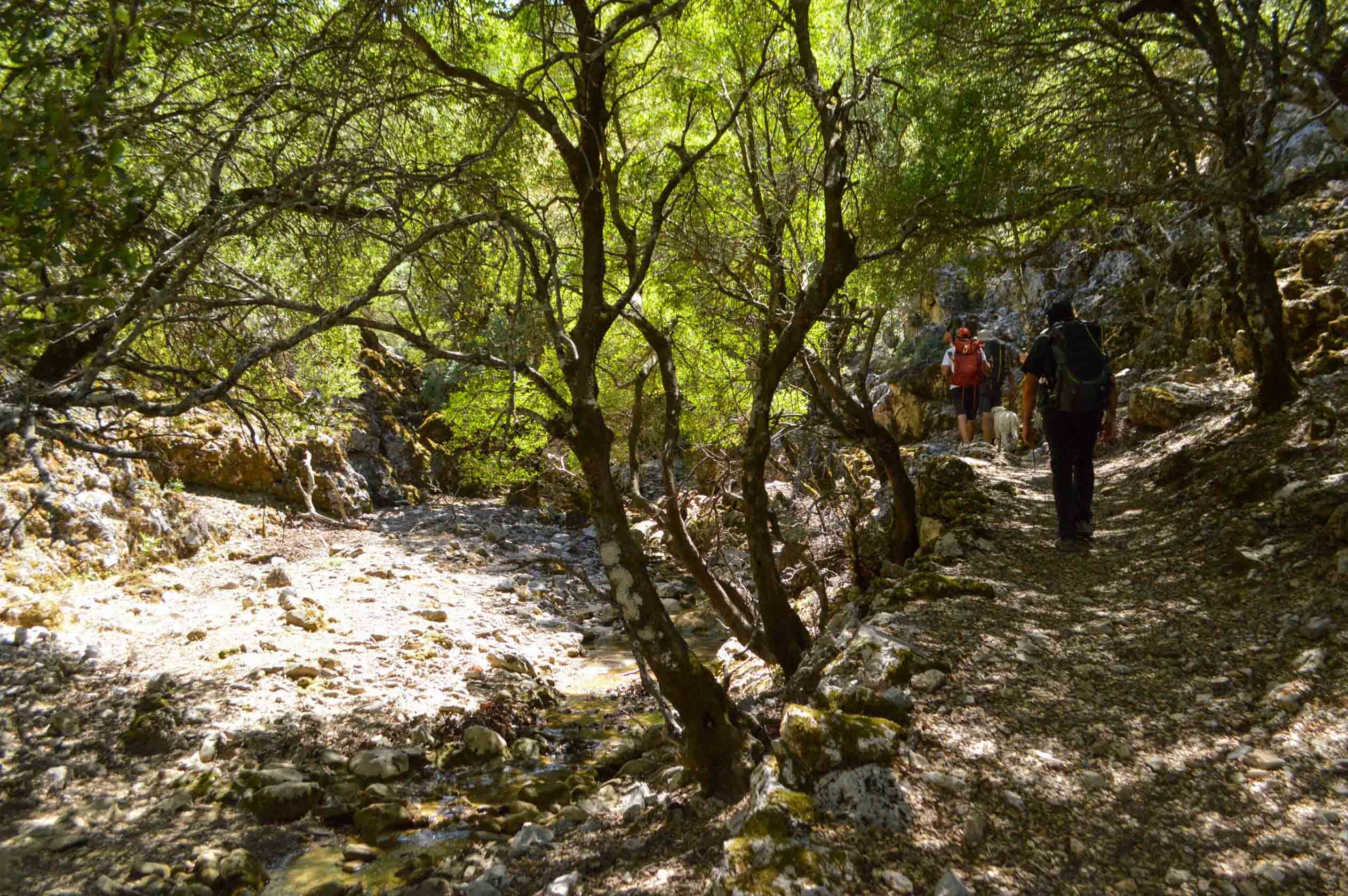
The southern side of Psiloritis offers a different picture from the bare mountain landscape. From Zaros, the trail enters the Agios Nikolaos gorge and climbs toward the Rouvas forest, one of Crete's most important forest cores.
Zaros–Rouvas: the hike starts near Lake Votomos and follows the E4 through the Agios Nikolaos gorge, especially striking in spring.
Vorizia and Kamares: a gateway to more demanding routes toward the higher zones, with pronounced geological relief and narrow passes.
Lasithi — Crete as geology and isolation
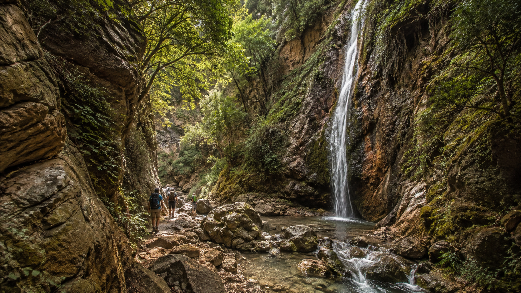
Eastern Crete has a smaller reputation as a hiking destination, but arguably the clearest network of themed geo-routes on the island. The Sitia UNESCO Global Geopark has mapped routes with length, duration, elevation, and specific geosites, so a hiker can read the landscape rather than just cross it.
Ano Zakros–Gorge of the Dead–Kato Zakros: Georoute 10, 4.3 km, roughly 1h 26m of pure walking time, passes the gorge where natural hollows were used as Minoan burial sites and ends beside the archaeological site of the Kato Zakros palace.
Richtis: Georoute 17, 5 km, roughly 1h 40m, from 391 m down to 14 m, with a waterfall around 20 m high.
Kato Zakros–Pelekita–Karoumes: Georoute 12, 7.9 km, roughly 2h 38m one way, marine terraces, the Pelekita Cave, and an ancient quarry — Karoumes has no road access.
When it is best to hike in Crete
Crete's coasts have mild winters and dry summers, but conditions on the mountain are entirely different. Between 1,500–2,400 m, temperatures can be noticeably lower, with strong wind, fog, or snow.
Spring: March and April are excellent for low-altitude trails and geo-routes; May is one of the best months overall, with a check needed for snow on the high peaks.
Summer: June with an early start can be very good. July and August require real care on exposed routes without shade.
Autumn: September and October are strong months again, with warm seas and lower temperatures.
Winter: low-altitude routes can be excellent on good days, but the high zones of Psiloritis and the White Mountains become genuine winter mountains.
Ταιριάζει αν
- You want multi-day hikes with real variety of landscape.
- You're interested in geology, history, and local routes, not just the view.
- You're comfortable with demanding routes, heat, and a lack of shade.
Ίσως όχι αν
- You only want easy, short walks with no preparation.
- You don't want to check weather, seasonality, or gorge opening status before you go.